2005 IRISH SCIENTIST YEAR BOOK

Home Page

Table of contents

Index by Author

Index by topics

Search


Geological Survey of Northern Ireland

Marie Cowan
The Tellus Project – understanding underground
a countrywide mapping project

A monumental new project is now well underway at the Geological Survey of Northern Ireland (GSNI). Known as the Tellus project, named after the Roman goddess of the earth, this survey will collect seamless airborne geophysical and ground geochemical data over Northern Ireland. This will provide baseline information to support sustainable development of natural resources and improve environmental management. The project is funded by the Department of Enterprise, Trade and Investment.


The GSNI Twin-Otter

The geophysical survey will be conducted using a DeHavilland Twin-Otter aircraft recently acquired by the Natural Environment Research Council from Finland. The system has previously been used in Finland to undertake a similar comprehensive national survey. The entire Northern Ireland land area will be flown with a line interval of 200m and three types of data will be collected: high-sensitivity magnetic field measurements in gradiometer mode, radiometrics and electromagnetics. This will occur over four month intervals during 2005 and 2006. The magnetic survey will support GSNI geological mapping of the region, particularly in areas of volcanic rocks or those covered by glacial material. The standard products of the radiometric survey will be maps showing distribution of the naturally occurring elements uranium, thorium and potassium. However, the method will also be used to map anthropogenic radioelements such as certain abnormal fertiliser distributions and caesium from fall-out. The electromagnetic survey will provide an electrical conductivity map of the near-surface. This data will be valuable for mineral prospecting, for determining the thickness of glacial cover, and for detecting acid or saline pollution plumes.

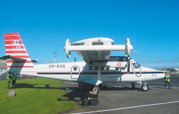
The geophysical survey is complimented by a geochemical survey involving the collection and analysis of soil, stream sediments and stream water samples. Major and minor element and heavy mineral data will provide a geochemical baseline survey of the surface environment for Northern Ireland and provide a better understanding of industrial and agricultural impacts on land and water. The data will also help detect leachate from landfill sites and land contamination in urban areas.

Data acquired during the project will be presented in the form of high quality, globally positioned, digital data and as geochemical and geophysical atlases and images. As well as being of great benefit to the Geological Survey of Northern Ireland, the data will assist ongoing projects in other government departments, e.g. Environment & Heritage Service, Planning Service, Forest Service, Water Service, Rivers Agency, and others within the Departments of Agriculture, Regional Development, Environment, and Public Health. The data is also expected to contribute to the work of mineral and hydrocarbon exploration companies, environmental and engineering consultancies and academic researchers. Geological conditions contributing to natural hazards such as subsidence, landslip and radioactivity may also be identified by the surveys.


Contact: Dr Marie Cowan, Deputy Manager,
Tellus Project, GSNI, Colby House, Stranmillis Court, Belfast, BT9 5BF;
Tel 028 9038 8462;
E-mail; [email protected]