| 2004 |

|
YEAR BOOK |
Bord Iascaigh Mhara � The Irish Sea Fisheries Board
|
BIM bluefin tuna tagging programme
|
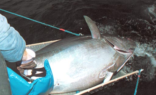
Recognising the fact that fishing of a novel species should not be allowed to expand faster than the acquisition of information necessary to provide a basis for effective management of the resource, BIM started a tagging programme for bluefin tuna in 2003. Carried out in collaboration with the 'Tag a Giant' team from Stanford University, California, and the Irish Game Fish Association, the programme aims to provide biological information, such as migratory paths, depth preferences and behaviour of bluefin tuna in Irish waters. This information will contribute to the knowledge and international management of this highly migratory species. A broader benefit of the programme is the creation of a culture of capture and release amongst Irish charter skippers and anglers, which will assist in conservation of this magnificent species.
The tags used are called 'pop-up archival transmitting' (PAT) tags, which are designed to track the large scale movements and behaviour of pelagic fish and other animals. Summaries of depth, temperature and light-level data are archived in the tag, while being towed by the animal. Neither the fish nor the tag needs to be retrieved in order to obtain these data. At a user-specified date and time, the PAT tag actively corrodes a pin to which a tether is attached, thus releasing the tag from the animal. It then floats to the surface and transmits the summarised information via the Argos satellite system. Daily longitude of the migration track is calculated onboard the PAT tag using geo-location by light level techniques. Daily latitude can be calculated from transmitted light level curves using software provided by the tag manufacturer. The results provide the migration path and depth and temperature preferences of the study animal, as well as oceanographic data in the form of depth-temperature profiles. Stanford University has reported a 90% data retrieval rate for bluefin tuna tagged with PAT tags, indicating a very high survival rate for captured and released bluefin tuna.
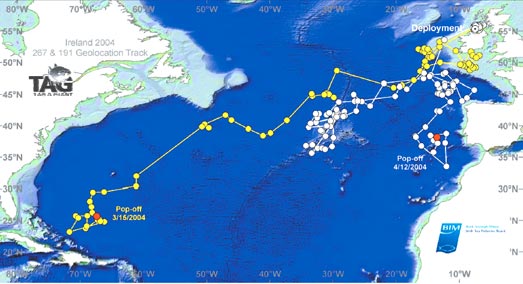
The data from the pop-ups which have occurred to date suggest that Ireland may be a feeding location for fish of eastern and western Atlantic origin. The tagging work continued in 2004.
Contact: Ronan Cosgrove, BIM, New Docks, Galway City, Co. Galway; E-mail: [email protected]